Tikal National Park, Petén, Guatemala, Central America
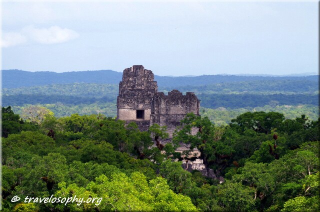
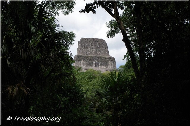
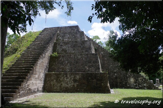
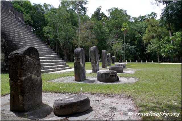
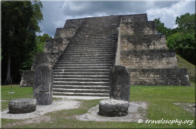
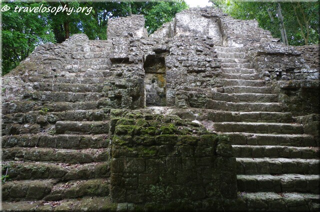
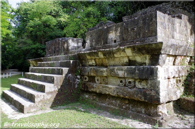
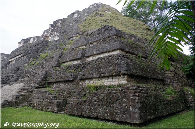
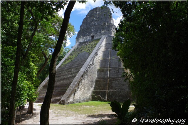
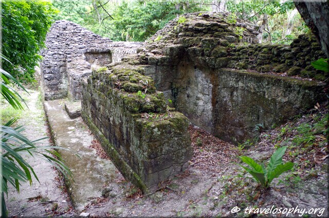
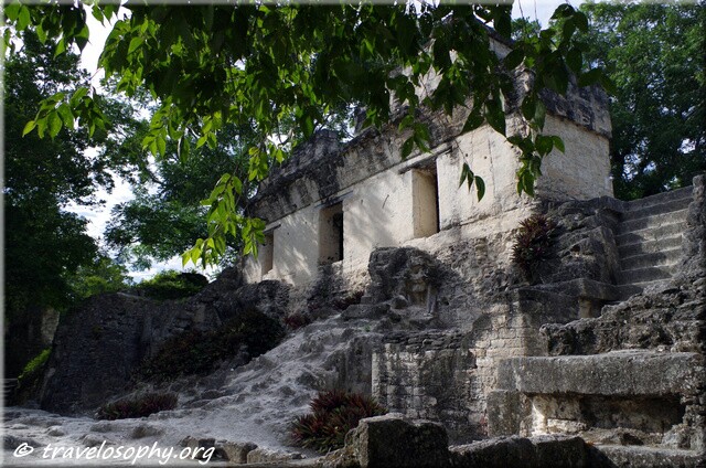
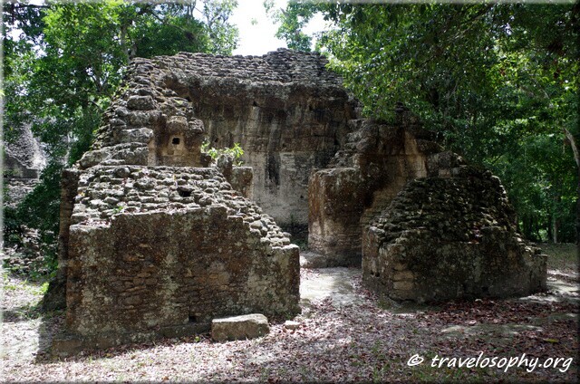
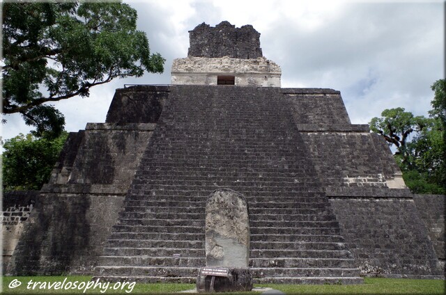
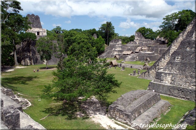
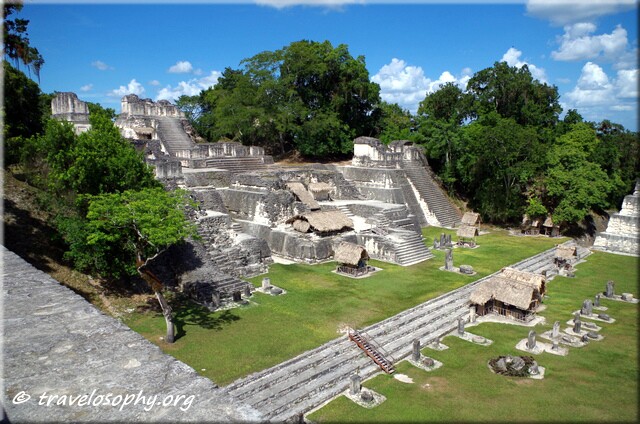
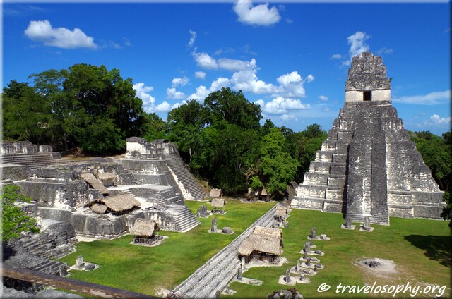
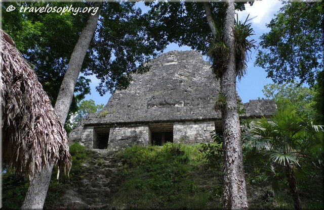
Tikal is the largest excavated Maya site in the Americas and once was one of the greatest and most prominent cities in all of the Maya world. Besides general sightseeing, of interest to me during my recent visit in September, was to get to know more about the advanced technologies and sophisticated infrastructure which could be found in Tikal in its heyday. I was also interested in learning more about the reasons for the eventual collapse of this advanced civilization.
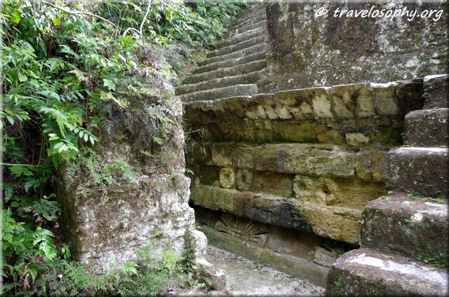
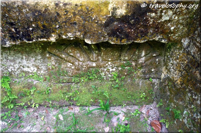
I hope these pictures below provide a concise visual walk-through of some of the main attractions in the excavated parts of this impressive and atmospheric archaeological national park.
– Jean-Jacques
“Tikal was discovered in 1848 by the Coronel Mondesto Mendez and Ambrosio Tut. It was opened to the public in 1955 and it was recognized as a site of “Humanity’s Heritage” by the UNESCO in 1979. Tikal in Mayan “Ti ak’ al” means “in the lagoon”, but it’s still known as “the place of the spirit voices”. The Mayan civilisation dates from the year 800 BC until 900 AD. Circa 750 AD, the nucleus of the city was about 65 (square) km’s. “
– The Official Park Guide Map, Tikal National Park
[click to view slides]


")

")
")


Water Technologies & Drought Patterns
Water
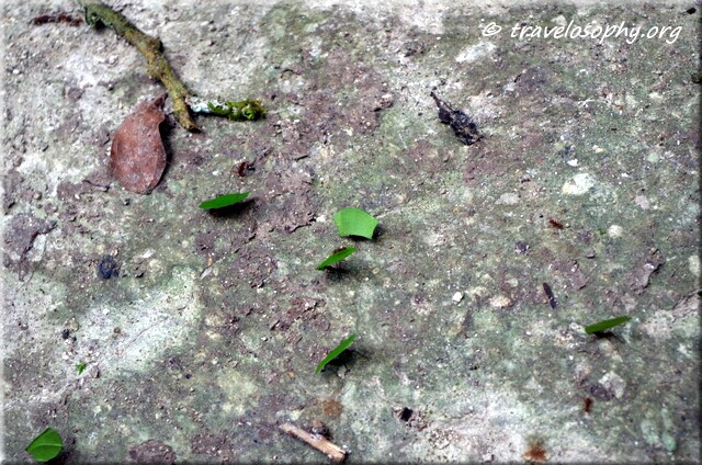
Due to Tikal’s geographic location, access to water was a major concern and a priority from the outset. In particular in relation to methods of water storage and retention, due to seasonality of the rainfall in the area and the nature of the soil. The Mayans therefore made use of water systems called “aguadas”, which were either natural and then modified, or were created by them in order to collect and store water for domestic and agricultural purposes. These aguadas were advanced water storage technologies incorporated by the builders of Tikal into the city’s infrastructure which allowed this very large human settlement of up to 100 000 inhabitants at its peak, to flourish within an area with significant water limitations. – JJM
Source: Ezgi Akpinar Ferrand, Benjamin Thomas III, Nicholas P. Dunning (2012), ‘Geovisualization and Analysis of Agudas: Natural or Human-made Ponds in the Southern Maya Lowlands’, ArchAtlas, Version 4.1, http://www.archatlas.org/occpaper/Ferrand.php, Accessed: 01 December 2015
Drought
Complex combinations of factors lead to the collapse of the Maya civilizations in Central America. One recurring theme seems to be a combination of deforestation and ensuing drought. In the case of Tikal more recent research similarly points to a high rate of deforestation, combined with the arrival of a significant reduction in rainfall, which most likely brought on the collapse of Tikal. The inhabitants had no choice but to abandon the city and disperse to have better access to water and food. Although small groups of people returned to live there, this magnificent ancient city with its advanced culture was never again fully revived and was eventually consumed by the jungle. – JJM
Sources:
Collapse of Mayan Civilization Traced to Dry Spells
What Was Behind Mysterious Collapse of the Mayan Empire?
**
Maya Sites Discovery – September 2015
Photography by Jean-Jacques M
Copyright © 2015 – All Rights Reserved – Gypsy Café
**
I would like to express my gratitude to the very helpful and friendly staff at the Antigua Tourist Information Office in Guatemala, who provide me with maps of Tikal as well as follow-up resources and information in relation to the history of the ancient Maya civilization. Visitors are encouraged to visit their office for official information on everything Maya and everything Guatemala:
Oficina de Información Turística / Tourist Information Office
INGUAT – Antigua Guatemala
5ª. Calle Oriente No. 11, Casa del Turista
(502) 7832-0787 ó 24212800 ext. 6010 / 6011
info-antigua@inguat.gob.gt
www.visitguatemala.com
www.geovisitguatemala.com
http://paseoguatemala.com
https://www.facebook.com/inguat.laantiguag
6 Comments
What an advanced civilization! Thanks for sharing this information and the beautiful photos with those of us who won’t be able to visit this magnificent site 🙂
Thank you Wolfgang for taking the tour with me – I’m glad you enjoyed the pictures!
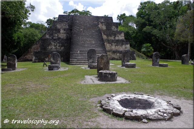
What a wonderful offering to bring forth on the day of the ancestors, Wisdom/CIB! The photography is beautiful and brings to life another place and time. I haven’t seen many pictures from this location – I love them all, and was particularly drawn to the one that shows the firepit in front of the standing stones that lead to the stairway of the pyramid. Thank you so much, in lak’ech. Debra
Thank you Debra – and yes, that I was guided to publish this today, I think is very relevant, CIB being the day of spending time in stone temples… I appreciate your support very much and very glad you could join me, so to say, in this adventure! J.J.
Thank you for sharing your words and photos! Tikal would be an amazing place to visit. I’m astounded at what the ancient Maya were able to accomplish, given the fact that they didn’t have access to modern power tools. They were a truly ingenious and determined civilization. Their fall also offers important lessons for modern humans: no matter how advanced we become we’re still dependent on the earth.
Thank you very much Josh for your comment! Perfectly summarised and concluded – even with very advanced technologies and methods (relatively speaking) as well as highly advanced astronomy and cosmology, and being very close to nature in many ways, the over-exploitation of their own environment caused the collapse of their civilisation. Hopefully we can all learn from this and return to prioritising the protection of the earth – in time – and re-learn how to care for the environment and the atmosphere.