The Classic Inca Trail
Peru, South America
Part 1
(January 7 – 10, 2016)
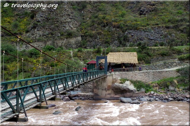
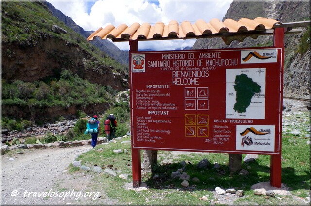
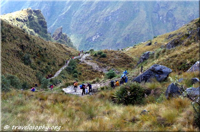
The Inca Trail is not what you think it is. Or rather, it was not what I thought it would be. I had no expectations. In fact I was slightly apprehensive about doing it, even up to two days before the start. The reason being that I was concerned that it would be too crowded or commercialised. In recent years the Classic Inca Trail has become one of the most famous and popular treks in the world.
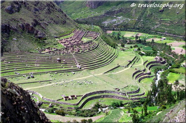
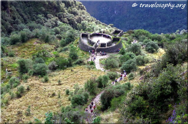
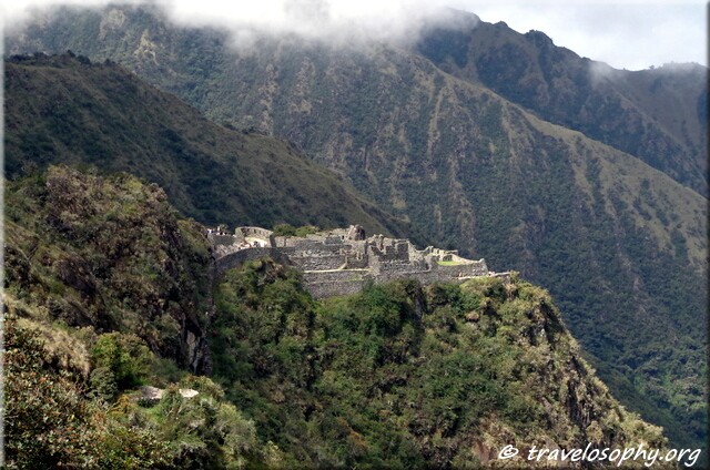
The trail can only be done by joining a group and solo-trekking is not allowed. Mountain hiking is a type of meditative process for me and I was not sure whether such a busy trail would be ideal for that kind of experience. However, this route was highly recommended by everyone and would be the most appropriate for viewing ancient sites and ruins along the way.
I decided to just go with the flow and enjoy the scenery. I did not make any special preparations, except for having all the necessary gear. As for fitness, I had done the Colca Canyon trail a few days earlier, which was quite tough due to the heat, but mainly because I was not very fit, (although) I hoped it would be a good “warming-up exercise” for the Inca Trail. Otherwise I would adapt to the pace during the first day or so.
To my pleasant surprise the group I joined was an extended family from Cusco, doing the Inca Trail as a highlight of their annual holidays. Some of them had done the trail before. The advantage was that we were a small group and I could do my own thing most of the time and also be social at times.
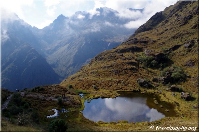
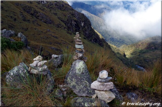
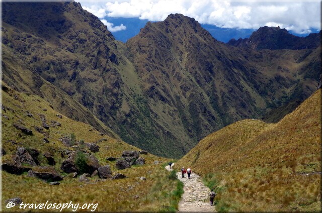
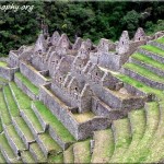
In a nutshell: The Inca Trail is a very personal experience for each individual hiker – more about that in Part 2. In the meantime, without any further ado, here are some visual highlights of the first 3 days – enjoy the views.
– Jean-Jacques


The Classic Inca Trail – January 2016
Photography by Jean-Jacques
Copyright © 2016 – All Rights Reserved – Gypsy Café
10 Comments
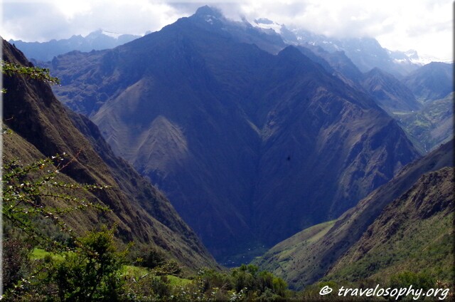
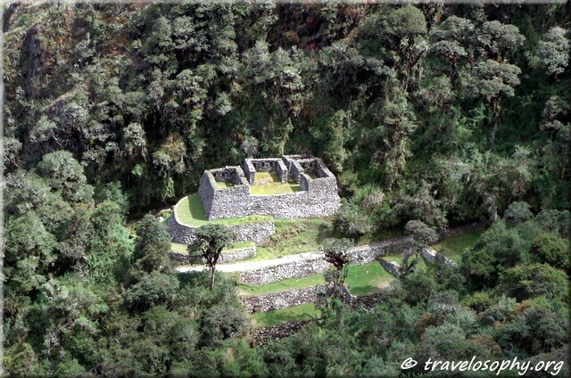
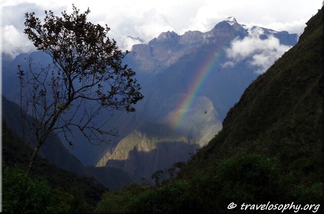
Amazing how steep those mountains are. Seems like you’d have to be in pretty good shape to make that climb. The landscaping was beautiful on the Llactapata photo and the rainbow must have been a beautiful site. Thanks for sharing – all beautiful. Elevation? I’m out of breath just looking.
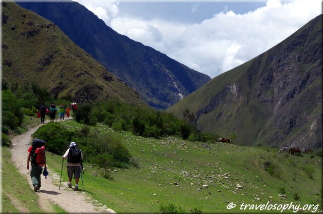
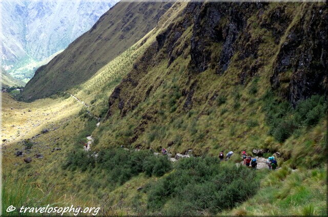
Very glad you enjoyed the pictures, Debra! Yes, those mountains are seriously steep, no jokes! Good that you mention elevation – I will add them to photos (where possible). The trail starts at around 2570m on Day 1 and on Day 2 ascends to the highest point on the trail at 4200m. It drops to around 3900m on Day 3 and on Day 4 it drops to 2680 at Machu Piccu. Being out of breath was the name of the game, but it was very conducive towards improving mental stamina! More in Part 2.
Such beautiful views! Mountain hiking is indeed an exhilarating experience.
Agreed, Josh! The exhilaration comes not only from the beautiful views, but from the strenuousness and being rewarded for your efforts 🙂 .
such a high
beautiful journey
i’m happy to have
been brought on 🙂
Thank you for coming along and for commenting, Smilecalm 🙂
Hello Jean-Jacques thank you for this tour. It’s my day off and I think I’m fortunate in being able to share some of your experiences in such exotic and thought provoking places. Take care of yourself !
Hello Diana, it’s good to hear from you – and thank you for joining me on some of my trails!
Having visited the Eco Shrine I would consider your location to be exotic and thought-provoking too… 🙂
In that sense we are both fortunate to be exposed to nature.
I’m happy to share my experience and I really appreciate your feedback!
Best wishes,
J.J.
This is beautiful Jean-Jacques, to see where on this beautiful planet your wandering soul has taken you. I marvel at your stamina, and love how you connected with a perfect family to wander with. Best of wishes from the woods of this Salish Isle! Mokihana
Aloha Mokihana – so glad that you stopped by – it has been a while. The pauses in-between make the visits worthwhile, -and I’m glad I revisited your blog too! “A pattern worthy of attention” is very interesting (!) -and I enjoyed reading about your recent activities. Also, the quote you have on your site by Gary Snyder is perfect for our current age: ”Find your place on the planet. Dig in, and take responsibility from there.” Thank you and best wishes from the Southern parts of South America.